
25 Best East Coast Hikes to Add to Your Bucket List
As a traveler and hiker born and raised in North Carolina, I know all too well how much time you can spend searching for the best East Coast hikes. Heck, even searching for the best hikes in your own state is overwhelming!
From the beautiful forests of Maine to the grand peaks of North Carolina to the Everglades of Florida, there’s no shortage of trails and routes to explore.
If you’re an avid hiker or adventure-seeker looking for some of the most challenging and rewarding hikes on the East Coast, I’ve put this bucket list of trails together with the help of a few other bloggers.
Hopefully, you’ll find a few new ones to add to your own bucket list.
- 25 Best Hikes on the East Coast
- 1. Mount Katahdin via Hunt Trail – Maine
- 2. Beehive Trail – Maine
- 3. Flume Gorge – New Hampshire
- 4. Killington Peak via Bucklin Trail – Vermont
- 5. Holyoke Range Traverse – Massachusetts
- 6. Indian Head – New York
- 7. Kaaterskill Falls – New York
- 8. Cascade Mountain – New York
- 9. The Falls Loop Trail at Ricketts Glen State Park – Pennsylvania
- 10. Castle Loop Trail – New Jersey
- 11. Billy Goat Trail – Maryland
- 12. Endless Wall – West Virginia
- 13. Natural Bridge – Kentucky
- 14. Old Rag – Virginia
- 15. Stony Man – Virginia
- 16. McAfee Knob – Virginia
- 17. Carvers Gap to Jane Bald – Tennessee/North Carolina
- 18. Abrams Falls – Tennessee
- 19. Crabtree Falls – North Carolina
- 20. Rough Ridge – North Carolina
- 21. Hanging Rock – North Carolina
- 22. Riley Moore Falls – South Carolina
- 23. Table Rock – South Carolina
- 24. Dismals Canyon – Alabama
- 25. Anhinga Trail – Florida
Disclaimer: This post may contain affiliate links. If you make a purchase through this link, I may earn a small commission at no additional cost to you. See my Disclosure Policy for more information. Thanks for keeping Stuck On The Go going!
25 Best Hikes on the East Coast
Here are 25 top hikes east of the Mississippi River. Of course, we couldn’t include all the best so and I know there are some iconic ones not on the list. Take Alum Cave to Mount LeConte (TN) and Grandfather Mountain (NC) for example.
Maybe one day I’ll expand this list to 50 of the best! While there are always more to add, I hope this gives you a good start!
If you want more ideas, Alum Cave and 14 others are included in my best hikes in the Southeast post.
1. Mount Katahdin via Hunt Trail – Maine
- Trail Length: 10.9 miles roundtrip
- Difficulty: Challenging
- Trail Type: Out & Back
- Park: Katahdin Stream Campground
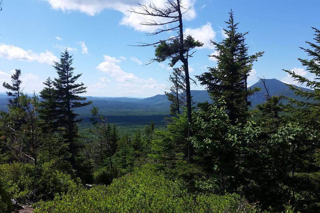
Deep inside Baxter State Park in the northern region of Maine sits the iconic Mount Katahdin, which is well-known as the highest mountain in the state. Standing at 5,269 feet tall, this peak is a classic destination for those looking to explore Maine’s backcountry.
The hike up Mount Katahdin via Hunt Trail is definitely no easy feat, but it’s well worth your time and effort if you’re seeking an adventure-filled experience!
Much of the journey is beneath the treeline, with the final stretch requiring some upper body strength as you traverse metal rungs bolted into the rockface, 7’+ tall boulders, and numerous rock scrambles.
The sheer drops can be intimidating to even the most experienced of hikers, so it’s recommended to bring a hiking buddy, and attempting the summit in inclement weather is not recommended.
However, on clear days, this 10.9-mile out-and-back trail supplies no shortage of challenges, with an elevation gain of 4,258 feet.
The journey to the top will provide you with epic mountain views of nearby Chimney Peak, Pamola Peak, and countless others, as well as toppling rocky mountain streams, rustic wooden bridges, and even the occasional wildflower or two.
When you reach the summit, prepare for unbeatable views over Baxter and even the chance to spot wildlife including moose, bears, and bald eagles.
Just be sure to arrive early to the parking area as limited space is available and there is zero cell service once you leave the main highway to research other trailheads.
Despite its popularity, owing to Katahdin’s remote location, this is easily one of the best hikes on the East Coast for those who prefer fewer people on the trail.
Plus, the spring brings rich, green overgrowth, chirping birds, and full rivers, making the Hunt Trail exceedingly peaceful.
Note – a parking reservation may be required and Baxter State Park charges an entrance fee.
Contributed by Emily of Emily Embarks
2. Beehive Trail – Maine
- Trail Length: 1.5 miles
- Difficulty: Hard
- Trail Type: Loop
- Park: Ocean Path Trailhead
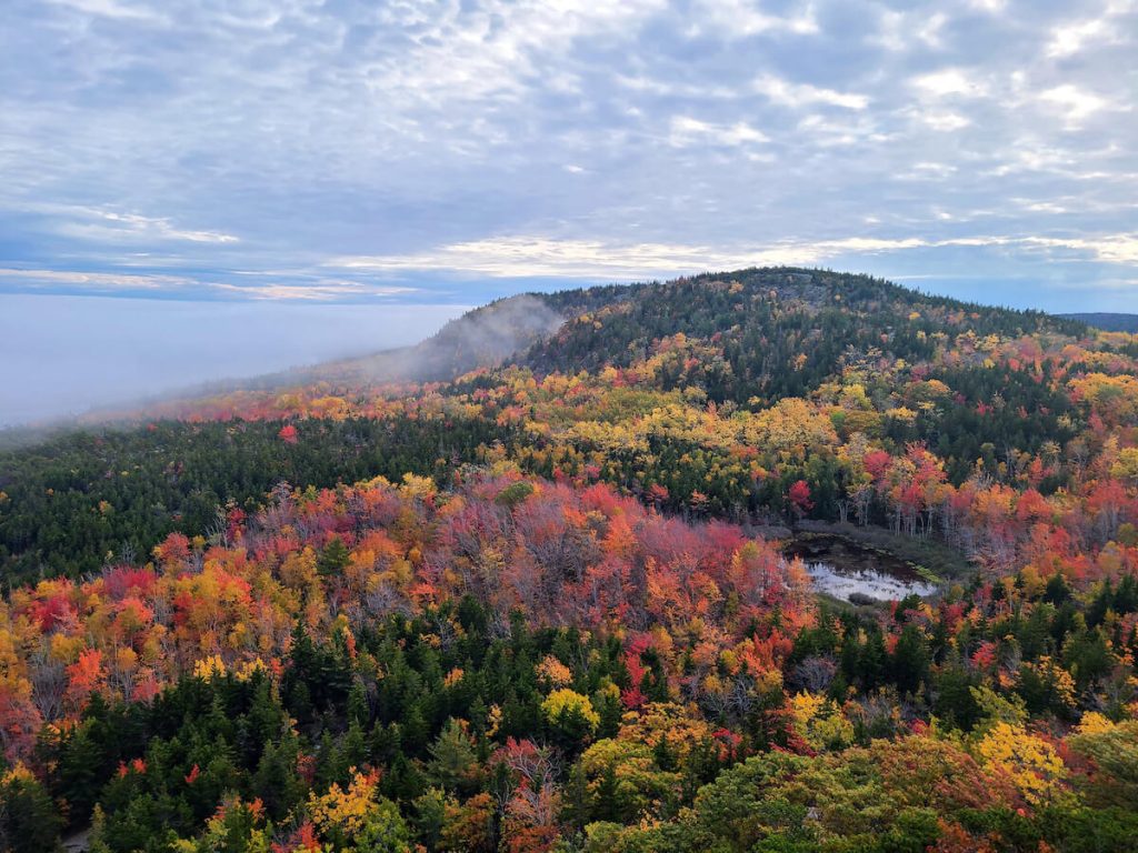
The Beehive Trail is one of the best trails in Acadia National Park for good reason! The trail involves climbing ladders and iron rungs that reward you with spectacular views of the ocean, beach and surrounding lakes.
However, you’ll want to avoid this trail if you’re afraid of heights. There are many steep drop-offs and cliff edges.
You will need to use your hands to climb the ladders and haul yourself up at a few points. Make sure to carry your hiking essentials in a backpack so that your hands are free. You should also wear hiking shoes for proper grip on the rocks.
Due to its popularity, parking can be difficult for The Beehive. It is best to get an early start to beat the crowds.
You should also make sure to hike up the ladders and down the backside of the mountain (counterclockwise). It is dangerous when people climb up and down the ladders at the same time.
When you reach the top, you’ll have a couple of options to complete the loop. If you want to see another scenic view, take the trail that passes The Bowl to see views of a large lake. There is also a quicker path if you’re short on time.
If you like adventure and the idea of scaling ladders sounds fun, make sure to add The Beehive to your Acadia itinerary! Not only are the views fantastic, but the climbing aspect will be sure to stick in your memories long after you’ve left.
You’ll definitely want a good long-sleeve shirt on this hike when the temperatures are cooler.
Contributed by Lydia of Lost With Lydia
3. Flume Gorge – New Hampshire

- Trail Length: 2 miles
- Difficulty: Easy
- Trail Type: Loop
- Park: Flume Gorge Visitor Center
One of the best hikes on the East Coast is Flume Gorge in New Hampshire. While this hike is famous for the fall colors that light it up each autumn, it is beautiful any time of year.
There is a large parking lot at the start of the trail, and it fills up in the fall due to the influx of people visiting the region. Other times of the year, it is much easier to find parking.
There is a fee to visit Flume Gorge other than in the winter when the gorge portion of the trail is closed. At the end of the season and the beginning of the season, the trail also closes to allow time for the workers to take out the boardwalk for the winter and then put it back in for the open season.
The gorge itself is stunning all year long. Even in the winter, this is one of the best waterfall hikes in New Hampshire. You’ll need spikes or snowshoes depending on the snow cover, and the gorge is popular with ice climbers.
In the summer, enjoy the greenery and the Flume Covered Bridge over a stream of crystal clear water. Come fall though, expect crowds as everyone wants to see the gorge covered in the oranges and reds that make the best photos.
This is a fairly easy hike overall and is worth the trip anytime you are in the area.
Contributed by Christine of Live Love Run Travel
4. Killington Peak via Bucklin Trail – Vermont
- Trail length: 7.2 miles
- Difficulty: Moderately challenging
- Trail type: Out & back
- Park: Bucklin Trailhead
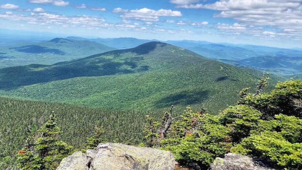
When looking for East Coast hikes in Vermont that offer panoramic vistas and a challenging workout along a peaceful wooded route with a fun scramble just before the summit, consider tackling the rewarding 7.2-mile out-and-back Killington Peak via Bucklin trail.
To reach the trailhead drive 3.9 miles along Wheelerville Road from the US-4 turnoff. You will find a well-marked gravel parking lot and clear trailhead signage.
On this road and along Bucklin Trail, plan for zero cell service. Download navigation or hiking contour maps in advance.
Once on the trail, expect to see a handful of other day and through hikers as you make your way along the gradual incline of the first two miles.
Then you will want to pace yourself as the shady and wooded trail progressively steepens. When you reach the summit, you will have gained a total of 2,473 feet in elevation.
Your efforts will be worth it. From Killington Peak, marvel at 360-degree views of Vermont’s Green Mountains. Be sure to pack a lunch to enjoy the view, as you will be hard-pressed to find a better place to picnic.
On the way back down, follow signage to take the small trail detour to pretty Irene Falls along Brewers Brook for a snack, a rest, and a chance to soak tired feet.
This hike is ideal to do in summer. In spring or winter—be prepared for ice and snow at higher elevations, and bring snowshoes, crampons, and ice axes if you plan to summit.
Contributed by Janice of Gather and Go Travel
5. Holyoke Range Traverse – Massachusetts
- Trail Length: 10.4 miles round trip
- Difficulty: Hard
- Trail Type: Point to Point
- Park: Skinner State Park or Notch Visitor’s Center
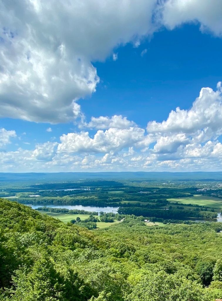
The Holyoke Range in Western Massachusetts offers some of the best hiking on the East Coast. The hike, known locally as the Seven Sisters, traverses the ridgeline of the Holyoke Range located near Hadley, MA.
The hike is strenuous but you are rewarded with the best views in Western Massachusetts including seeing three surrounding states.
The trailhead parking is on Old Mountain Road at the base of Skinner State Park. The hike is one way so you will need to spot a car at the Notch Visitor Center at the end.
Start hiking on the Two Forest trail to see the Devil’s Football, a cabin size boulder left by the glacier in the last Ice Age. Soon you will join the M & M trail to the top of Mount Holyoke.
Admire the historic Summit House atop the mountain. It’s one of the first summit hotels built in New England and now serves as an interpretive center.
From Mount Holyoke, the trail descends through Taylor Notch before climbing the first of the Seven Sisters. Follow the ridge line trail over the many peaks and valleys of the Seven Sisters.
You will swear there are more than seven on this strenuous section. Eventually, Mount Hitchcock, the highest of the peaks, is reached.
Next, cruise over Bare Mountain’s bald summit for incredible views of the Connecticut River Valley. Finally, you will descend Bare to the Notch to find your shuttle car.
Contributed by Karen of Outdoor Adventure Sampler
6. Indian Head – New York

- Trail Length: 10.8 miles roundtrip
- Difficulty: Hard
- Trail Type: Can be done as loop or out & back
- Park: St. Huberts Parking Lot
Located in the Adirondack mountain region of upstate New York, Indian Head is an iconic hike near the town of Keene Valley.
While the trail is technically rated as hard, the gain is very gradual so experienced hikers probably will find this more moderate. There are no technical or scrambling sections of the trail and the total elevation gain is 1,978ft.
What makes this hike really special is the viewpoint at the end, with views of the Ausable lakes surrounded by high peaks. Lower Lake Ausable is perfectly centered between walls of mountains and endless trees.
It is one of the most spectacular fall foliage views you can get in the Northeast and the best hike in the Adirondacks! The trail up to the viewpoint also features numerous waterfalls.
Note that you can do this hike in the winter months if you are prepared with snowshoes and/or microspikes. Another tip – dogs are not allowed.
You also must have a permit to do this hike May 1- October 31. Create an account with AMR (Adirondack Mountain Reserve) and make a reservation exactly 2 weeks in advance from when you plan to hike. Reservations open at 12PM each day.
Contributed by Kate of Kate Roams the World
7. Kaaterskill Falls – New York
- Trail Length: 2.5 miles round trip
- Difficulty: Moderate
- Trail Type: Out & back
- Park: Kaaterskill Falls
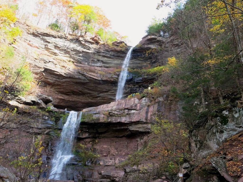
Located in the Catskill Mountains of upstate New York is the famous Kaaterskill Falls. This two-tiered waterfall has been a popular east coast hiking destination for centuries.
In 1826, painter Thomas Cole immortalized Kaaterskill Falls in his painting of the same name. Today, Kaaterskill Falls is a must-see spot in the Catskills and one of the most iconic hikes along the US east coast.
The Kaaterskill Falls hike is a moderate out-and-back trail totaling just over 2.5 miles. There is a parking lot for the hike along State Route 23A, but it gets crowded, so be sure to arrive early to secure a spot.
If the lot is full, avoid the urge to park along the highway – police regularly ticket vehicles parked along the road. Once parked, you will walk for 0.2 miles along 23A to reach the trailhead.
The hike begins with a steep uphill climb but eventually levels out to a more moderate uphill. Early on in the hike, you’ll be rewarded with a view of Bastion Falls, a short and wide waterfall that contrasts with the tall and narrow Kaaterskill Falls.
From Bastion Falls, you’ll continue hiking alongside a creek through the forest until you reach Kaaterskill Falls, marking the end of your hike.
Once you reach the falls, be sure to linger and take in the magnificence of this splendid waterfall. For an added challenge, continue up the newly built stairway to the top of the falls. There you can access a viewing platform with incredible views of Catskill Valley.
This hike is especially wonderful in the fall when the forest is awash in vibrant reds, yellows, and oranges.
Contributed by Tamar of World by Weekend
8. Cascade Mountain – New York

- Trail length: 4.8 miles round trip
- Difficulty: Moderate/Hard
- Trail Type: Out & back
- Park: Cascade Mountain Trailhead
Cascade Mountain Trail is a popular hiking trail located in Lake Placid, New York, known for its stunning views and challenging terrain.
Hikers on this trail can expect to encounter a diverse range of natural beauty along the way. The trail starts in a dense forest of coniferous trees, with a well-defined path that winds through the lush greenery.
As hikers ascend, they will pass over rugged terrain, including exposed tree roots and rocky sections that require careful footing.
As hikers continue up the trail, they will begin to catch glimpses of the surrounding landscape through breaks in the trees.
Moving higher, the views become more expansive, offering breathtaking panoramas of the surrounding Adirondack High Peaks, including neighboring mountains such as Porter Mountain and Whiteface Mountain.
The summit of Cascade Mountain itself offers a rocky, open expanse with incredible vistas in all directions, making it a perfect spot for a well-deserved rest and photo opps!
The views from Cascade Mountain are truly incredible! On a clear day, hikers can see vast stretches of pristine wilderness, with impressive peaks, deep valleys, and sparkling lakes dotting the landscape.
The panoramic vistas showcase the beauty of the Adirondack Mountains, with their dense forests, dramatic cliffs, and stunning alpine scenery.
As hikers take in the breathtaking views from the summit of Cascade Mountain, they will be rewarded with a sense of accomplishment and awe-inspiring natural beauty that makes the challenging hike worthwhile.
Note that crampons can be very helpful (& sometimes necessary) in the winter and bug spray is handy in the humid summer months. Also, there is no parking lot near the trailhead of this hike, you will need to find a spot on the side of the road!
Contributed by Courts of Postcards by Courts
9. The Falls Loop Trail at Ricketts Glen State Park – Pennsylvania
- Trail Length: 7.2 miles
- Difficulty: Moderate
- Trail Type: Loop
- Park: Lake Rose Trailhead
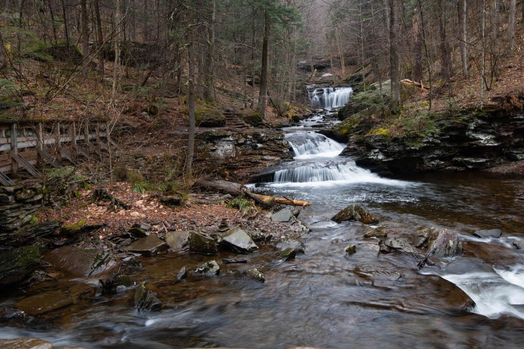
The Falls Loop Trail in Ricketts Glen State Park is one of the best hikes on the East Coast. Over the trail’s 7.2 miles, you’ll have close-up views of 21 of the park’s 22 named waterfalls!
Along the trail, you’ll explore both Glen Leigh and Ganoga Glen. The waterfalls you’ll pass range in height from about 10 feet to 94 feet!
Parking for this hike can be found on Route 118, or at the Lake Rose Trailhead inside the park. This hike does get quite busy on the weekends and during the summer, so try to plan your visit at an off time for a less crowded experience.
The trail itself is quite narrow in many spots and crosses rocky, uneven stairs. There aren’t any railings or barriers, so you’ll need to supervise young hikers closely. Make sure you wear secure shoes with good tread. Flip-flops are not appropriate or safe for this hike.
The Falls Trail at Ricketts Glen is best explored during the spring or fall. During the spring, the higher water levels really show the power of the falls, and the fall colors transform the gorges into a completely different experience.
The trail does close during the winter for everyone except for those who have ice-climbing equipment including crampons, a rope, and an ice axe. The trail runs in such close proximity to the waterfalls that the spray freezes over, coating the trail in thick layers of ice.
Contributed by Samantha of PA on Pause
10. Castle Loop Trail – New Jersey

- Trail Length: 3.1 miles
- Difficulty: Moderate
- Trail Type: Loop
- Trailhead: 265 Skyline Dr, Oakland, NJ 07436
Castle Loop Trail is a lesser-known hike in North New Jersey. This hidden gem in Ramapo Mountain State Forest offers amazing views of the water tower and castle ruins. You can also see the Midtown Manhattan skyline on a clear day.
The trailhead is easy to miss. Slow down and pull over to a large unmarked parking lot at 265 Skyline Dr.
Four hiking trails start at this trailhead. Follow infrequent white trail markers for the Castle Loop Trail. Or download an offline trail map to keep track of your location.
Take the loop in a counterclockwise direction to get to the ruins faster. But beware: most of the trail’s 460-ft elevation gain takes place in this section.
Get ready for several steep uphill and downhill sections over forested rocky terrain. An unmarked overlook at Wanaque Reservoir will mark the end of this trail section.
Soon you will arrive at the well-preserved Ramapo Water Tower. The tower will make you forget that you are hiking in New Jersey. It looks far more similar to the medieval structures in Ireland.
The Van Slyke Castle is the next sight on the trail. The castle was vandalized in the 1950s and is now in ruins. The trail quickly loses elevation after the ruins and merges with the Ramapo Lake Loop.
You can enjoy a lakeshore stroll for half a mile. The rest of the trail is a gradual ascend to the parking lot on an unpaved country road.
Contributed by Anastasia of Travel Realist
11. Billy Goat Trail – Maryland
- Trail Length: 8 miles round trip
- Difficulty: Moderate
- Trail Type: Out and back
- Park: Great Falls Tavern Visitor Center
Take a break from the urban bustle of Capitol Hill by exploring Maryland’s highly underrated natural landscape. Located 30 minutes by car from Washington DC, Billy Goat Trail provides a beautiful morning or afternoon getaway.
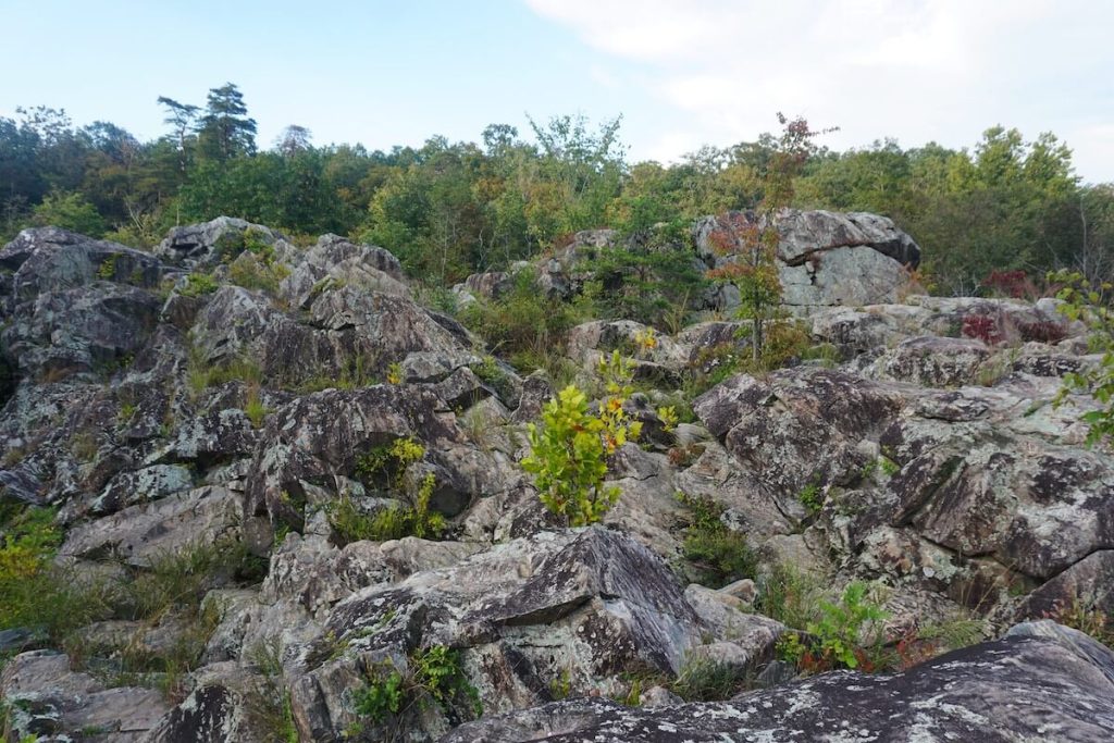
Billy Goat Trail in the Ohio Canal National Historical Park along the Potomac River. It is unique in that the trail itself is divided into three separate sub-trails.
These three sections do not connect and are individual trails in their own right. Each section can be completed out and back. Hikers can complete all three sections in 8 miles, or choose to hike just one section of the trail.
Section A is 4.8 miles and leads to the Great Falls Overlook. This route is considered the most strenuous. While many visitors complete this section out and back, it is now recommended to complete one way (just the top or just the bottom).
Section B is 2.7 miles and is currently closed (as of April 2023). Section C is 2.8 miles and considered the least strenuous section.
Swimming in the Potomac River along the trail is not permitted. Pets are allowed on Billy Goat sections B and C only. Check the National Park Service website for safety conditions and closures prior to beginning your hike.
Contributed by Alyssa of An Apple and a Plane
12. Endless Wall – West Virginia
- Trail Length: 2.7-mile loop, or 2-mile out-and-back
- Trail difficulty: Moderate
- Trail type: Loop or out-and-back
- Park: Endless Wall Trailhead
If you’re looking for an epic hike in West Virginia, look no further than the Endless Wall Trail, one of the top things to do in New River Gorge National Park.
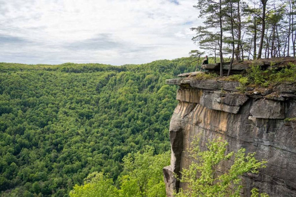
This trail passes through lush forest, crosses a creek, and then follows a cliff edge known as the “Endless Wall.” The Endless Wall is popular with local rock climbers, and also offers up excellent views down into the New River Gorge.
The Endless Wall Trail can be done as a 2-mile out-and-back hike with the viewpoint at Diamond Point as your turn-around spot, or you can continue on and turn it into a 2.7-mile loop hike.
Just note that for the loop, you’ll have to walk along a road for the final half mile back to the parking area.
The trail itself has some slight elevation gain here and then, and you can expect uneven ground in spots where there are rocks, roots, or mud after bad weather.
The trail is rated as moderate, but is suitable for kids who won’t get too close to cliff edges – and dogs are allowed (leashed) on this trail, too!
While you can easily do this hike in a little over an hour, you’ll want to allow some extra time to enjoy the view at Diamond Point. Here, the sandstone cliffs drop off about 900 feet, giving incredible views out over the gorge and the New River far below.
Contributed by Amanda of A Dangerous Business
13. Natural Bridge – Kentucky
- Trail Length: 1.6 Miles Total
- Difficulty: Moderate
- Trail Type: Out and Back
- Park: Natural Bridge Trailhead
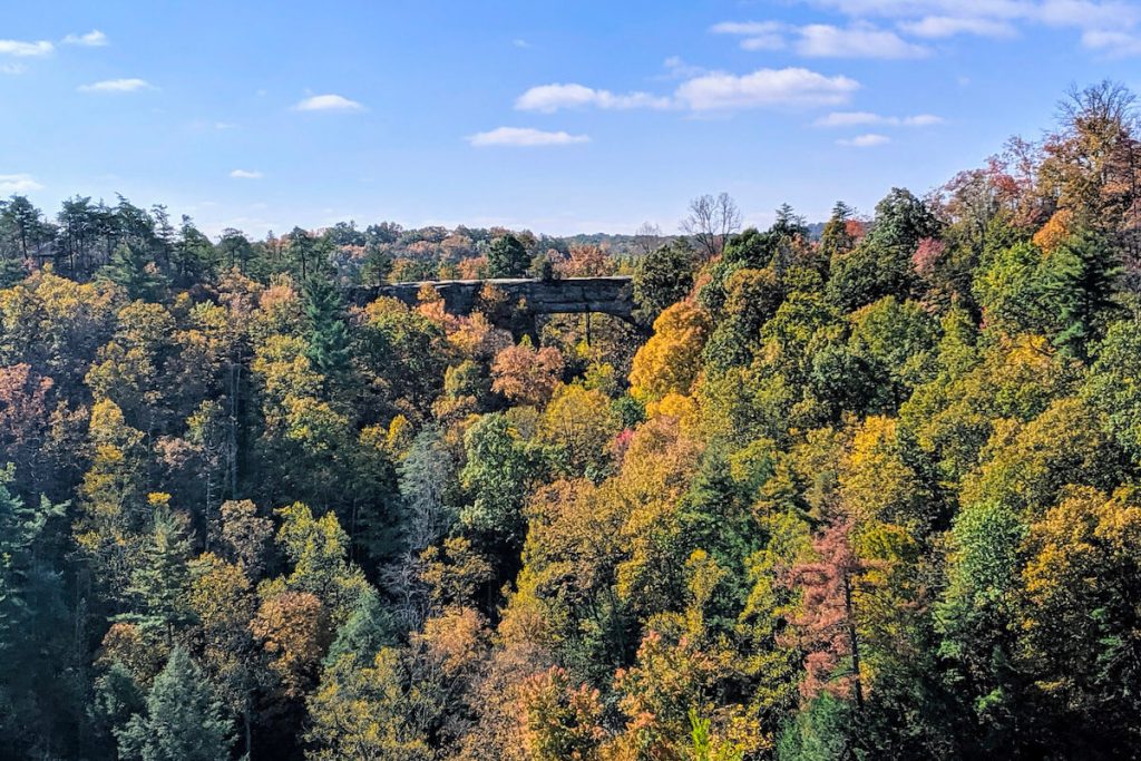
Natural Bridge is the iconic hike in Kentucky’s Red River Gorge. The Red River Gorge is home to more than 100 sandstone arches. So, it’s kind of like the Arches National Park on the east coast!
At the end of this hike, you’re rewarded with a giant natural sandstone arch. The best part is that you can see it from below and hike up to walk on top of it!
The trail is very well-developed so it’s easy to follow. The hike up gains 500 ft. of elevation. If you want to go quickly you can get your heart rate up. But, there are benches and shelters along the trail if you need to take a break.
If you choose to go to the top of the arch, which you should, there are no rails along the edge. Smaller children can do the hike but should be aware of the risk on top of the arch. But, it’s a perfect spot for a picnic or a snack.
If you want the best view of the arch, cross the bridge at the top and keep walking on the mostly flat trail to Lover’s Leap. When you look back toward the arch you’ll get an outstanding view.
This hike, and the whole area, is stunning in the fall when the leaves are changing but it is nice in any season. Natural Bridge is by far the most popular hike in the area so go early or expect to see some crowds.
Contributed by Jami of Celiac Travel Pack
14. Old Rag – Virginia
- Trail Length: 9.8 miles
- Difficulty: Hard
- Trail Type: Loop
- Park: Old Rag Trailhead
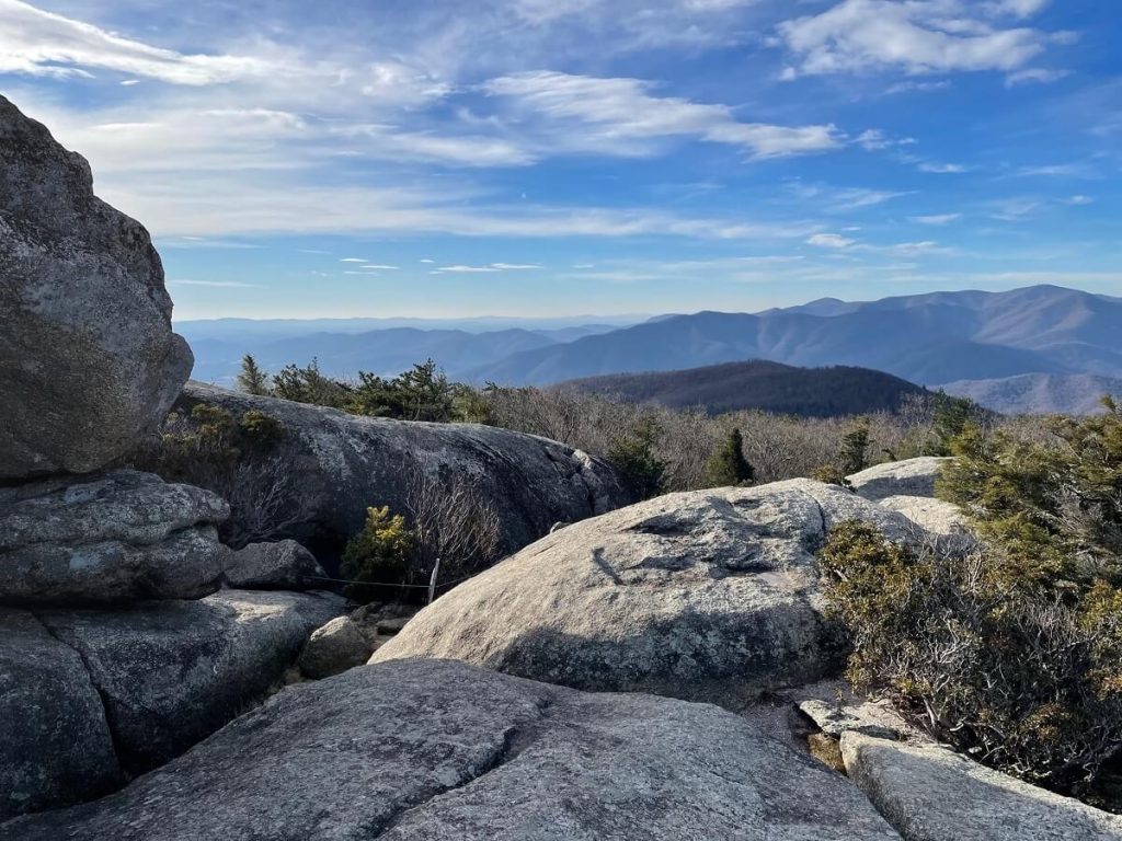
The 9.8-mile Old Rag hike at Shenandoah National Park in Virginia has been ranked among the best hikes in the world.
This exhilarating hike guides intrepid park-goers to a rocky summit with spectacular far-reaching views.
This hike is not for everyone, however. One mile of this hike is a challenging rock scramble that requires hikers to navigate tight spaces, shimmy down granite surfaces and hoist yourself up onto boulders and large rocks. There is also an elevation gain of 2,608 feet to reach the summit.
Thankfully, you will be rewarded with stunning 360-degree panoramas. There’s a lot of space to sit, snack and savor the vistas, too.
From here, the trail descends to reach a couple of day-use shelters with picnic tables and several bridges to cross over cascading Brokenback Run.
There is a park entry fee of $30 per vehicle (good for seven days). A day hike permit is also required to hike Old Rag between March 1 and November 30.
Permits cost $1 per person and can be purchased online at www.recreation.gov. Permits cannot be purchased on-site. Cell phone service is nearly non-existent, except at the summit, and dogs are not allowed at Old Rag, largely due to the rock scramble.
Contributed by Erin of Go Hike Virginia
15. Stony Man – Virginia

- Trail Length: 1.6 miles
- Difficulty: Easy
- Trail Type: Out & back
- Park: Stony Man Trail
The Stony Man Trail is an incredible hike that offers the chance to experience a piece of the iconic Appalachian Trail without much hassle.
The trailhead has a large parking area and the relatively easy 1.6-mile round trip path along the AT leads you to stunning views and is especially great at sunset.
Like many of the hikes in Shenandoah National Park, the trail is rocky so sturdy boots are still nice even though the trail is easy.
At the peak you’ll find a rocky outcropping where you can sit and enjoy views of the Shenandoah Valley. Remember there is a $30 fee to enter Shenandoah National Park!
The lot for this hike is at the entrance to the Skyland Lodge area so after you’re done, head to the restaurant and get some delicious blackberry ice cream pie.
16. McAfee Knob – Virginia
- Trail Length: 7.8 miles round trip
- Difficulty: Moderate
- Trail Type: Out & back
- Park: McAfee Knob Trailhead
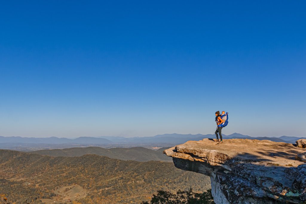
McAfee Knob is the most photographed location along the Appalachian Trail, located just outside of Roanoke, Virginia.
Hikers can walk out onto the ledge for an incredible panoramic view of the surrounding mountains and valleys. Sunrise and sunset are both spectacular from this viewpoint as vibrant colors illuminate the open sky.
Although there is an elevation gain of 1,740 feet, this hike is still considered moderate and family-friendly. Should you bring young children, be sure to use a sturdy hiking carrier for better support and comfort.
The Knob protrudes well beyond the surrounding cliffs with significant drops below. Using a proper carrier will eliminate any risk of them running off or getting injured.
This particular trail is often hiked as an out-and-back trail, however, it is also part of the Appalachian Trail and the popular 34-mile Triple Crown loop.
Because McAfee Knob is one of the most popular hikes in Virginia, the trail can get very crowded on the weekends. It is recommended that you arrive very early to ensure that you can find a parking spot.
Should the main parking lot on VA311 be full, there are 3 alternative parking areas at the Catawba Sustainability Center, the Catawba Community Center (both extend the length of the hike to about 10 miles), and the Carpool Parking area located at 37.3071812, -80.0704427.
Contributed by Cecilia of Lovicarious
17. Carvers Gap to Jane Bald – Tennessee/North Carolina
- Trail Length: 2.6 miles round trip
- Difficulty: Moderate
- Trail Type: Out & back
- Park: Carvers Gap
Hiking to Jane Bald from Carvers Gap is an iconic experience along the NC/TN border. While it is incredibly busy on the weekends, if you arrive early you have a better chance of landing. parking spot.
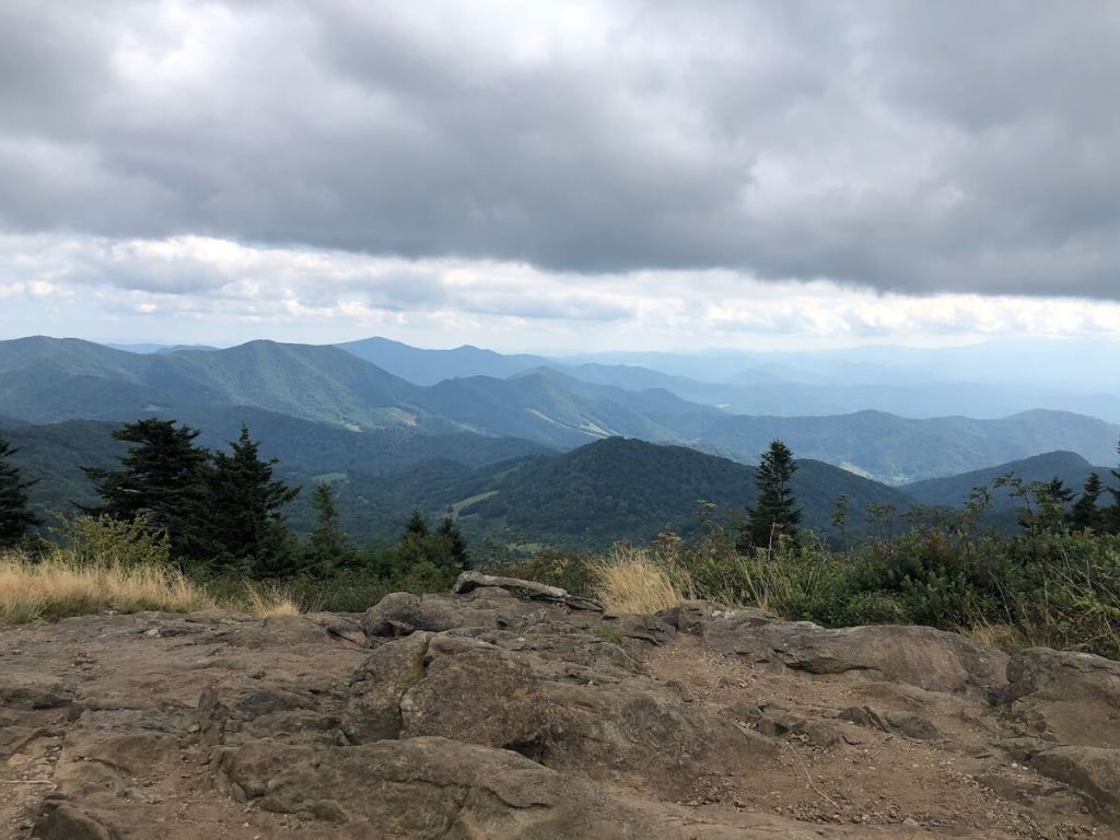
On the way up you walk through what feels like an enchanted forest with the towering trees and moss-lined path. As you come to Round Bald, you are greeted by many rhododendron plants that bloom in the early summer months.
Round Bald offers stunning views of the Blue Ridge Mountains and if you need a shorter/easier hike then you can turn around at this point. If you’re looking for more of a workout though, head further down the trail to Jane Bald.
Cell service is spotty around Roan Mountain State Park so just keep that in mind. It’s one of the best hikes near Johnson City, TN so be sure to visit if you’re in the area.
18. Abrams Falls – Tennessee
- Trail Length: 5.2 miles round trip
- Difficulty: Moderate
- Trail Type: Out & back
- Park: Abrams Falls Trail
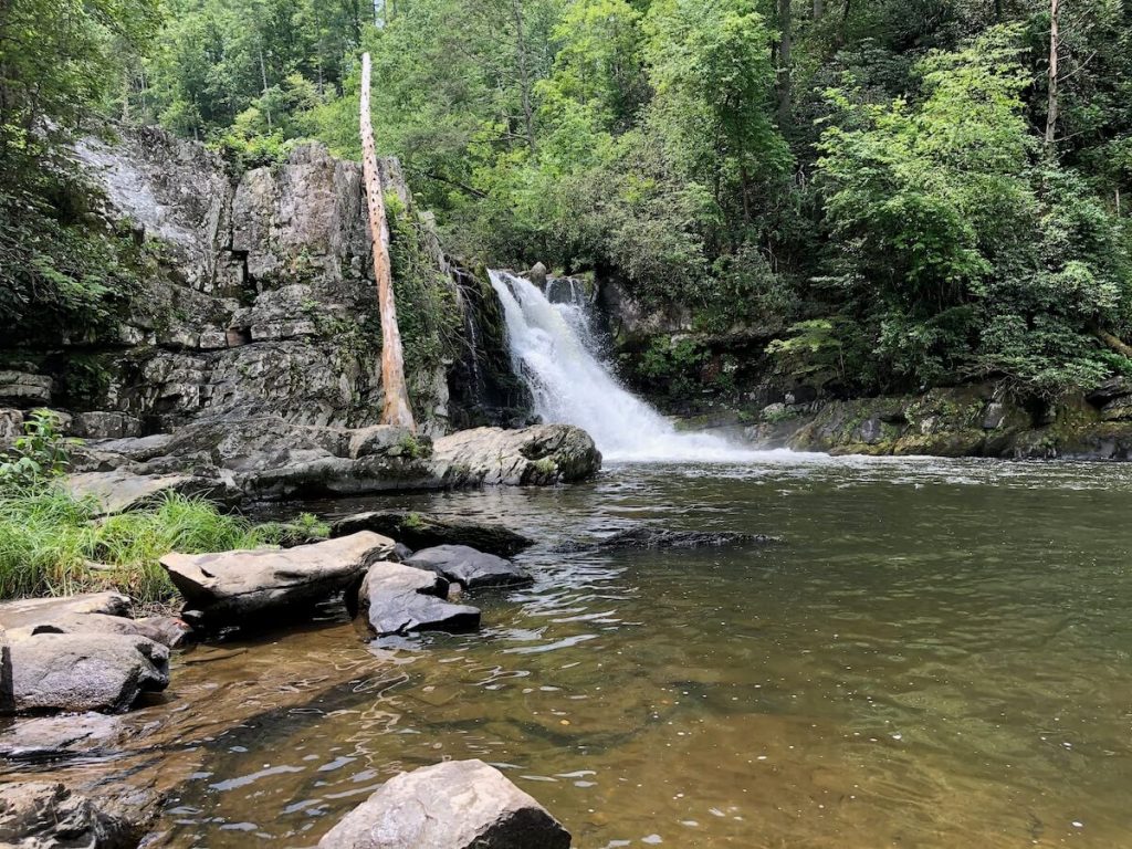
This stunning waterfall in the heart of Great Smoky Mountains National Park stands 20 feet tall and is the largest waterfall by volume in the Smokies.
The hike leads you by a creek for most of the way and there are a couple of creek crossings on narrow bridges. You’ll want to wear sturdy shoes because it is pretty rocky in areas too.
Once you make it to the falls, there are plenty of places to sit and enjoy a snack or a packed sandwich.
You can also dip your toes in the water but it is very dangerous to swim near the falls! The powerful currents have killed multiple people here.
Bring a snack (the perfect stocking stuffer for hikers) so you can enjoy it at the base of the falls.
Dogs are not allowed on this trail so leave your furry friends at home. The parking lot is located off of the Cades Cove loop which closes to automotive traffic some days so you’ll want to check when that is open and what the hours are. It can also take a while to get around the loop.
Also note that GSMNP has implemented a new parking system where you must pay for a parking tag if you are parking longer than 15 minutes.
If you’re looking for East Coast hikes featuring stunning waterfalls, this is the perfect pick!
19. Crabtree Falls – North Carolina
- Trail Length: 2.5 miles
- Difficulty: Moderate/Hard
- Trail Type: Loop
- Park: Crabtree Falls Campground
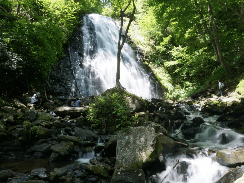
Crabtree Falls is truly an awe-inspiring sight, standing 60 feet tall and cascading over the rocky face of a mountain in the Blue Ridge Mountains. No matter how many times I see it, my jaw drops when I reach the base.
The hike in is relatively easy, with a gradual decline, but the switchbacks on the other side make this trail more challenging. If you need an easier route then just do this as an out & back trail.
This is definitely a popular waterfall along the Blue Ridge Parkway so you will likely share the trail with other hikers if you are visiting on a weekend.
While online it says the Campground is open, it has always been deserted and grown over when we’ve hiked this trail. The parking lot for the trail is to the left just as you turn in the entrance though.
You’ll want to explore the nearby towns and check out the fun things to do in Black Mountain if you are visiting this area.
20. Rough Ridge – North Carolina

- Trail Length: 1.5 miles round trip
- Difficulty: Moderate
- Trail Type: Out & back
- Park: Rough Ridge Trail
This relatively short hike offers some incredible views of Grandfather Mountain and is one of the best hikes near Boone and along the Blue Ridge Parkway.
The parking lot is *very* small so it even fills up on some Fridays – especially when students are in town at App State. If this is the case, then just park at Boulder Fields and extend your hike. on the Tanawha Trail.
There are some wooden staircases and viewing platforms on this trail where you can stop and admire the views but the biggest draw on this hike is the rock ledge that juts out where many people get their picture taken.
The trail has loose rocks in some areas so be sure to wear good hiking boots. This is also a great hike for a picnic – especially if you park at Boulder Fields.
21. Hanging Rock – North Carolina
- Trail Length: 2.6 miles round trip
- Difficulty: Moderate/Hard
- Trail Type: Out & back
- Park: Hanging Rock Visitor Center
North Carolina is known for its stunning mountain hikes but we have a few great ones in the Piedmont as well. Hanging Rock State Park is one of the most popular state parks in NC.
Another popular spot on the weekends, this is an iconic NC trail since it’s easy to reach from the Triad and Triangle cities.
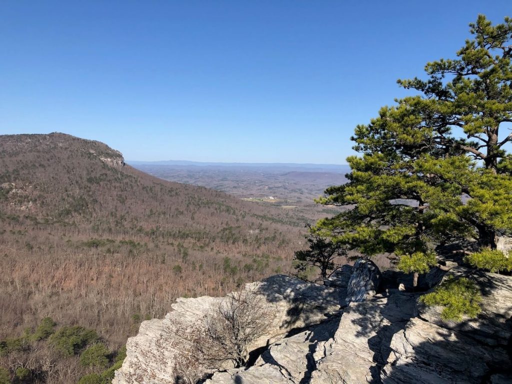
The trail is through a wooded area the entire way until you get to the namesake Hanging Rock where you can walk out on this rocky outcropping and enjoy the view. The trial itself gets pretty rocky once you get closer to the summit and the total elevation gain is 603ft.
However, you are rewarded with beautiful views of the Sauratown Mountain Range and rolling farmland of the Piedmont! It’s one of the best hikes near Winston-Salem by far.
22. Riley Moore Falls – South Carolina
- Trail Length: 2 miles round trip
- Difficulty: Easy
- Trail Type: Out & back
- Park: Trailhead or State Road
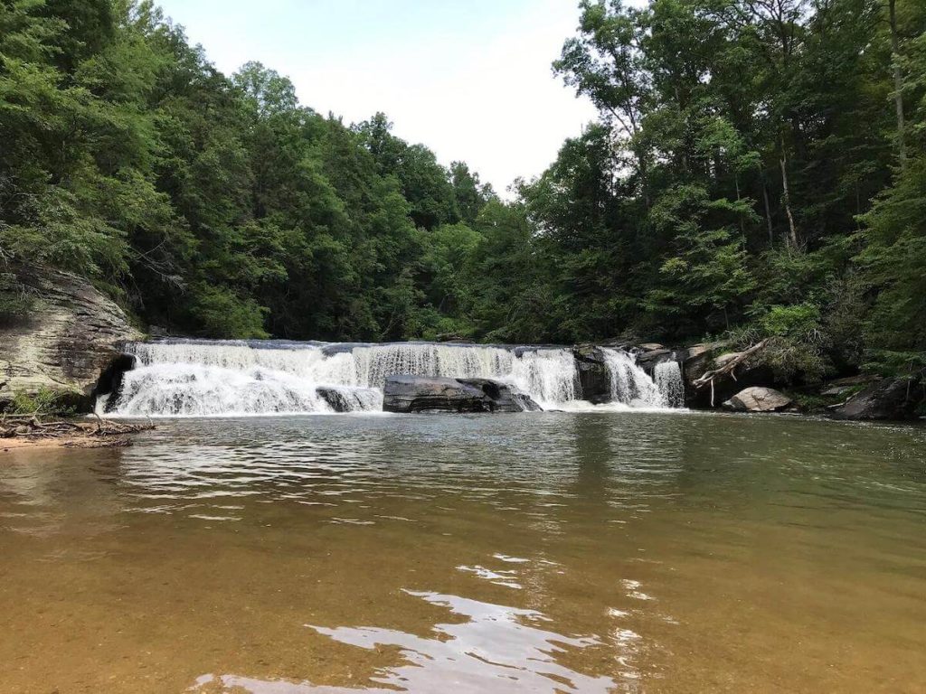
If you have a free afternoon on a warm day, Riley Moore Falls is one of the best waterfalls near Westminster, South Carolina!
While the total hike is 2 miles round trip from the trailhead, you should consider walking the approximately 0.4 mile unpaved forest road in addition.
Walking down to the trailhead means you will skip driving on the connecting road, which has deep potholes and a dramatic drop-off.
Only attempt this drive if you have a high-clearance vehicle and the weather has been dry.
Still, the trouble of getting to the trailhead is worth it as you’ll soon be enveloped in the quiet forest as the wide, well-maintained trail gently descends to the river below.
After a last-minute scramble down a few rocks, you’ll arrive at Riley Moore Falls.
This is one of the best hikes in the area for families as there is a wide, sandy beach and a wonderfully cool swimming hole in front of the waterfall.
Plan to spend plenty of time splashing around before you head back out into the forest for your return hike!
While the trail does have a slight incline on the way back, this hike is overall quite easy for such a great pay-off.
Access the trail via State Road 37-748; the entrance to the one-way unpaved road to the trailhead is about 1.8 miles down the state road.
Contributed by Natalie of Camping Kiddos
23. Table Rock – South Carolina
- Trail Length: 7.2 miles round trip
- Difficulty: Hard / Very Strenuous
- Trail Type: Out & back
- Park: Table Rock Nature Center
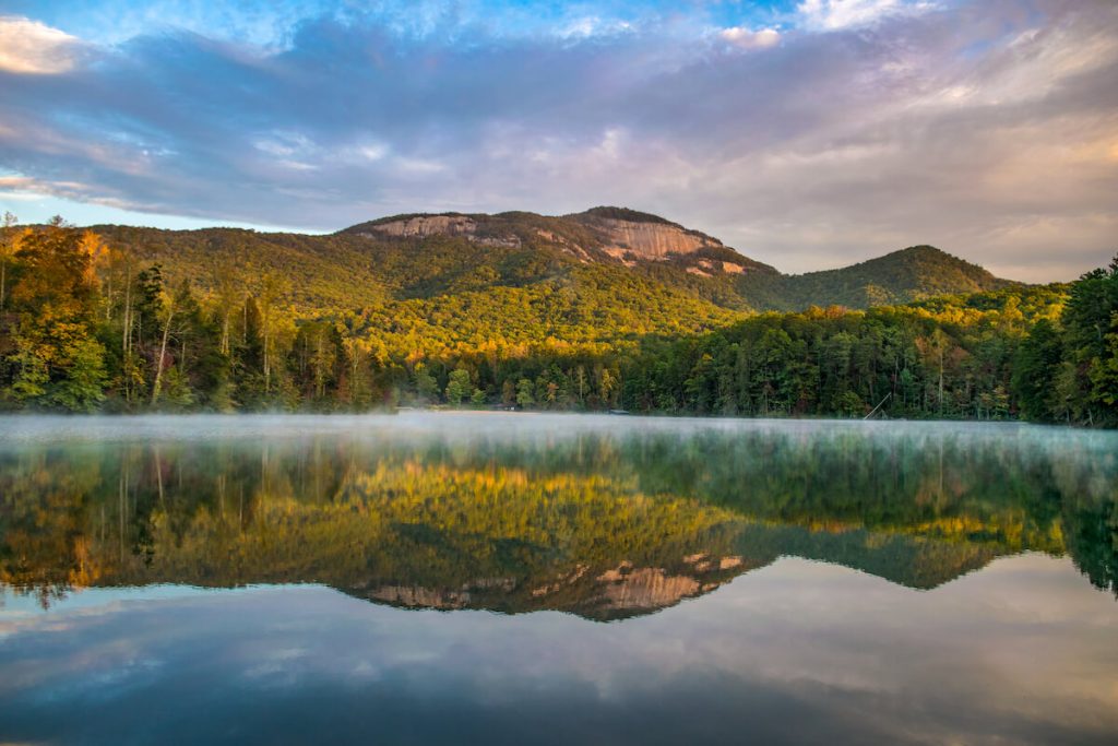
Table Rock State Park, located near Pickens, South Carolina, is a beautiful example of the state’s geological features within the Blue Ridge Mountains and perfect for hiking.
Boulders, waterfalls, and lush greenery await on the heart-pumping namesake hike: Table Rock Trail.
Admission to the park is $6 for adults, with discounts for seniors and children over 5 (children under 5 are free). Tip: bring cash!
Parking is available at the park’s Nature Center which is a short drive along the loop connecting the park’s East and West entrances (see map here). Dogs are allowed in the park and on the trail but must be kept on a leash at all times.
Hikers are asked to register at the trailhead kiosk or Nature Center before setting off on the trail. Along the way, you will encounter steep and rocky terrain, boulders, and even a waterfall – Carrick Creek Falls.
The trail is also lined with lots of green vegetation in the warmer months which offers lovely shade not seen on the summit’s bald boulders. However, the view from the top more than makes up for the exposure, with sweeping views of the park’s trees and lakes below.
Note that the trails and park close at sunset for those not staying overnight. Visitors can also camp in the park with tents or RV, or rent a cabin. The spots fill up fast in the summer, so reservations are recommended.
Contributed by Michele of Adventures Abound
24. Dismals Canyon – Alabama

- Trail Length: 1.5 miles
- Difficulty: Easy
- Trail Type: Loop
- Park: Dismals Canyon
Although Alabama may not be the first state that comes to mind when thinking of the best hikes on the East Coast, a trek on the magical Dismals Canyon trail will surely change your mind.
Throughout the 1.5-mile trail, you’ll traverse along the mossy green canyon floor. You’ll cross a swinging bridge, squeeze through slot canyons, marvel at waterfalls, and even explore secret caves! It’s truly a magical and slightly mysterious experience.
And, if you weren’t wowed enough by the daytime hike, you can return at night for a unique Dismalites tour.
Dismals Canyon is actually one of the only places in the entire world where you can find these glowing blue worms.
It does cost $12 to enter to the canyon floor, but once you are on the trail you can hang out all day long.
The night tour requires an additional fee and advanced reservations. It sells out most of the time, so be sure to prepare ahead!
Contributed by Jordan of The Homebody Tourist
25. Anhinga Trail – Florida

- Trail Length: 0.8 miles
- Difficulty: Easy
- Trail Type: Loop
- Park: Royal Palm Visitor Center
While this is a short and easy (and sometimes crowded) East Coast hike, the wildlife you typically see here more than makes up for it.
The parking lot is large but there are vultures that hang out in the area so the park service provides a few blankets people can use to cover their windshield.
Apparently, the vultures have gotten on cars before and picked at the windshield wipers. They don’t provide enough for everyone so consider bringing your own.
This trail is partly paved and the rest is a boardwalk that takes you through the sawgrass marsh. Winter is the best time. to see wildlife and birds are especially common here.
You’ll typically see anhingas but can also find herons, egrets, and many other birds here as well. Other animals you might see include a variety of turtles and alligators.
There is a $30 fee per vehicle to enter Everglades National Park and that is good for 7 days.

