
Hiking Near Johnson City, TN: 10 Trails Not to Miss
If you are planning on going hiking near Johnson City, TN, then you’ll have no shortage of fantastic options.
I’ve visited Johnson City a few times now, and each time I’ve gotten to experience a few different hikes. There are so many good ones!
The best part is you don’t have to travel far to reach some of the best hikes near Johnson City. For example, just 10 minutes outside of town, you’ll find Buffalo Mountain Park.
Whether you’re looking for a leisurely walk or a strenuous trail to get your heart pumping, you’ll find it here in Northeast Tennessee.
Disclaimer: This post may contain affiliate links. If you make a purchase through this link, I may earn a small commission at no additional cost to you. Thanks for keeping Stuck On The Go going! I was hosted by Visit Johnson City during my time in town. All opinions are my own.
🥾 Want to download trail maps for all these hikes? Check out AllTrails+ for trail maps, tracking, and finding the best trails all over the country! 🥾
10 Best Hikes Near Johnson City, TN
While there are so many more than ten, here are a few of the best hiking trails near Johnson City.
Distances listed are for the round trip hike unless otherwise noted and pulled from AllTrails data. Actual distance may vary.
1. Buffalo Mountain Park

- Distance: 5.1 miles (entire White Rock loop)
- Type: Loop
- Rating: Strenuous
- Dog friendly? Yes
- AllTrails: White Rock Loop
In my opinion, Buffalo Mountain Park offers some of the best hiking trails in Johnson City due to the proximity to town and the rewarding views with minimal effort.
It’s also one of the best city parks that I’ve ever been to and the perfect place to see sunrise or sunset.
White Rock Loop is one of the most popular trails in the park but the entire trail is just over 5 miles and considered strenuous.
If you’re looking for something easier, then from the White Rock Loop trailhead, take a right and go up to Huckleberry Knob and Sunset Point.
Huckleberry Knob is just 0.25 miles from the trailhead and Sunset Point is 0.39 miles from the same trailhead. There is a slight incline to get here but these overlooks are so close that you will barely notice.
These are the perfect overlooks to sit and watch the sunrise or sunset. Even on a Saturday morning in the summer, there was only one other couple here that shared the trail at sunrise.
An added bonus – the trailhead was only 10 minutes from where I was staying at The Carnegie Hotel. So I didn’t even have to wake up super early to catch the sunrise.
Do note that the opening hours are listed as 7am but when I got to the park at 6:40am the gate was open.
This is a great place to hike through the forest with well-maintained trails and beautiful overlooks of the surrounding mountains and valleys.
It’s easy to come early in the morning and then head back to grab a delicious breakfast at one of the restaurants in Johnson City.
2. Nolichucky Overlook
- Distance: 1.6 miles
- Type: Out & Back
- Rating: Moderate
- Dog friendly? Yes
- AllTrails: Nolichucky Ridge
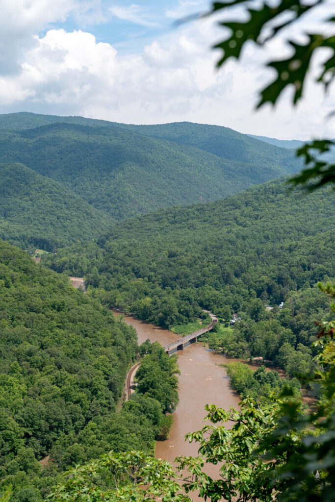
The Nolichucky Overlook is a beautiful hike that starts near Uncle Johnny’s Hostel right beside the Nolichucky River and follows the Appalachian Trail up to the overlook.
If there’s no parking available on that side of the river, then you can park across the bridge at the AT Trailhead at Chestoa. Then just walk back across the bridge.
The hike is about 1.6 miles with approximately 524 ft of elevation gain, according to AllTrails. There are a few switchbacks but the incline is relatively gradual.
After the climb, you are rewarded with a beautiful view of the Nolichucky River with a train trestle passing over it. You may even hear the train coming through.
The hike is through the forest for the entire way and you’ll see lots of rhododendrons and mossy banks beside the trail.
3. Carvers Gap to Jane Bald
- Distance: 2.6 miles
- Type: Out & Back
- Rating: Moderate
- Dog friendly? Yes
- AllTrails: Jane Bald
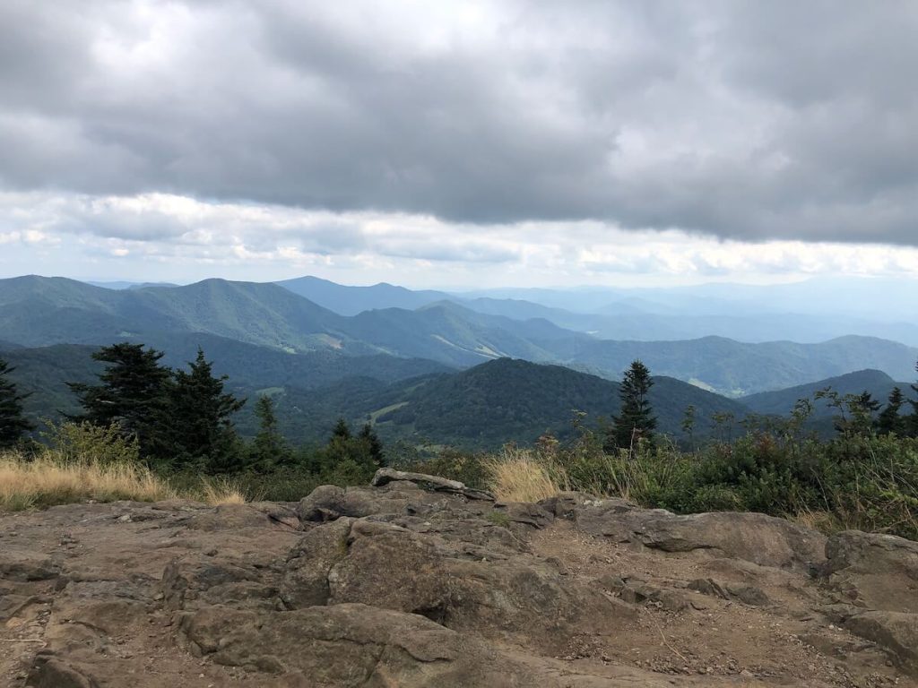
This one is one of my all-time favorite hikes near Johnson City! Personally, I think it’s hard to beat the views of the Roan Highlands.
It’s where you can get the iconic layered Blue Ridge Mountain views.
The hike out to Jane Bald is 2.6 miles out and back but if you wanted to make it shorter, you could just hike up to Round Bald which is the first bald that you come to.
On the other hand, if you wanted something a bit harder then you could tack on hiking out to Grassy Ridge Bald from Jane Bald which totals about 5 miles.
The hike out to Jane Bald is considered moderate and toward the end, it gets steep and rocky. I can’t say enough about the views, though. They are well worth it.
If you come when the rhododendrons are blooming then it’s even more beautiful! Peak bloom is typically during the third week of June. Another beautiful feature is the spruce-fir forest that you get to hike through.
There is very limited parking for Carver’s Gap so you will want to get here early! Have a backup plan in case you can’t find parking.
4. Tweetsie Trail
- Distance: 9.6 miles (one way)
- Type: Out & Back
- Rating: Easy (AllTrails rates moderate due to length)
- Dog friendly? Yes
- AllTrails: Tweetsie Trail
Another great place for hiking in Johnson City is the Tweetsie Trail. It’s a rails-to-trails project so many people use it for biking but it’s a wonderful walking path as well.
The trail is 9.6 miles and connects Johnson City to Elizabethton. Along the way, you’ll find plenty of benches, overlooks, informational markers, and beautiful scenery.
The distance you cover is completely up to you but if you wanted to hike or bike the whole trail then you could set up a shuttle so a car is waiting for you at the other end of the trail.
This is one of the best options if you’re looking for something easy and don’t want to travel outside of town. It’s very dog-friendly as well!
5. Beauty Spot to Unaka Mountain
- Distance: 6.6 miles
- Type: Out & Back
- Rating: Moderate
- Dog friendly? Yes
- AllTrails: Beauty Spot to Unaka Mountain
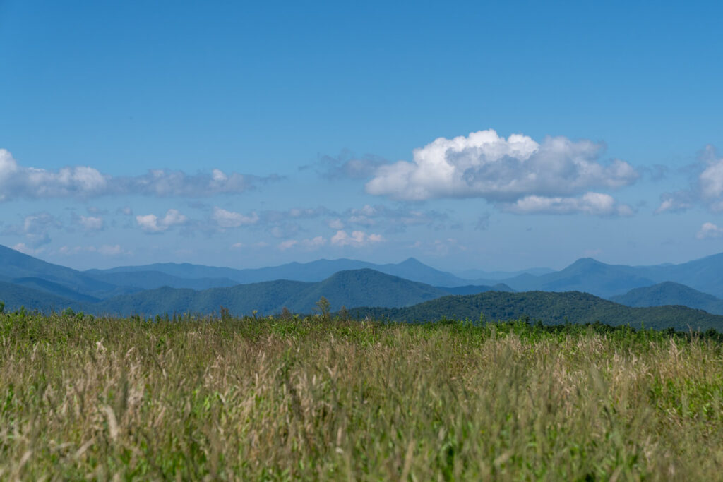
One of the most popular places near town to watch sunrise or sunset is Beauty Spot because there are beautiful mountain views and you only have to walk a couple hundred feet or less from the parking lot.
If you’re looking for a workout, then hiking to Unaka (pronounced similar to “snake”) Mountain from Beauty Spot is just the thing for you.
Hike through forests, flower fields, and rhododendron tunnels up to a stunning red spruce forest on Unaka Mountain. It’s also known as “The Emerald Forest” because of the moss that covers the base of the trees and part of the ground.
This is a pretty tough one as it’s 6.6 miles with ~1,700 ft of elevation gain, according to AllTrails. They have it rated as moderate but I would consider portions of this trail strenuous.
While Beauty Spot is a popular place for sunset, this hike is a bit less popular than some of the surrounding ones as you don’t get any mountain views along the way.
This makes it a perfect hiking trail near Johnson City to avoid crowds and the Emerald Forest is something to see itself.
Make sure you leave time to stop at Scott’s Farm Market for ice cream on your way back. It’s one of the best places for ice cream near Johnson City.
6. Whitehouse Cliffs Trail
- Distance: 2 miles
- Type: Out & Back
- Rating: Strenuous
- Dog friendly? Yes
- AllTrails: Whitehouse Cliffs
If you’re looking for a quick hike with a rewarding view, the Whitehouse Cliffs Trail in Rocky Fork State Park is the perfect choice.
While the trail is relatively short, it’s definitely steep and a bit rocky at the top, so you’ll want your hiking boots and plenty of water.
Depending on the season, the bugs at the top can be a little pesky so be prepared for that. The mountain views are definitely worth it though.
Rocky Fork State Park has multiple other trails if you’re looking for a different experience – many of them follow the creeks in the park.
Since it’s in a state park, there are plenty of parking and restroom facilities here. This is a popular one on the weekends, so get here early!
8. Pinnacle Mountain Fire Tower
- Distance: 9.9 miles
- Type: Out & Back
- Rating: Strenuous
- Dog friendly? Yes
- AllTrails: Pinnacle Mountain Fire Tower
If you’re up for a bit of a challenge, this might be the hike for you. The trail follows a steady incline with a few steeper spots, so prepare to get a good workout.
There is plenty of parking at the trailhead and even a relatively clean bathroom with a flush toilet.
Some sites list this as a 9.6-mile hike, but I clocked in at around 9.3-miles when I tracked my hike with AllTrails+. Total elevation gain was just over 1,800 ft.
The trail winds through the woods and it really is a gorgeous hike. There is one small creek crossing but there hadn’t been recent rain when I visited so I’m not sure how large it gets.
The trail can be narrow in some places with steep drop-offs on the side so if you have a reactive/unfriendly dog, this may not be the trail for you.
Once you’re about two-thirds of the way up, you’ll come to a small gravel lot where multiple trails and a gravel road intersect. Be sure to pay attention to the green blazes because it’s easy to get off track here.
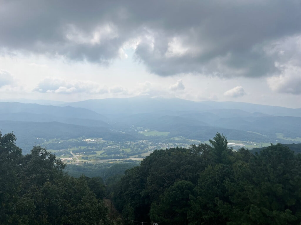
Once you reach the summit, you won’t be able to see any views unless you climb the tower because of the trees. My dog, Barley, didn’t want to climb the tower so I had to tie her off at the bottom while I ran up to snap a few pictures.
You can see Johnson City, Unicoi, and Erwin from the top and of course, the gorgeous Blue Ridge Mountains. We did the hike in late August and the gnats were pretty bad at the base of the fire tower.
Be aware that there are black bears in the area! While we didn’t see one, I’m 90% sure we scared one off through the brush. I also ran into a lady who mentioned she saw one there the week before.
We did see a black snake making its way across the trail as well as a little chipmunk. You’ll also see plenty of people as this is one of the most popular hiking trails near Johnson City.
I can promise you after this trail, you’ll want to visit one of the breweries in Johnson City and relax with a drink.
7. Laurel Falls Trail
- Distance: 2.5 miles OR 4.6 miles (two options)
- Type: Out & Back
- Rating: Both moderate
- Dog friendly? Yes
- AllTrails: Shorter version OR longer version
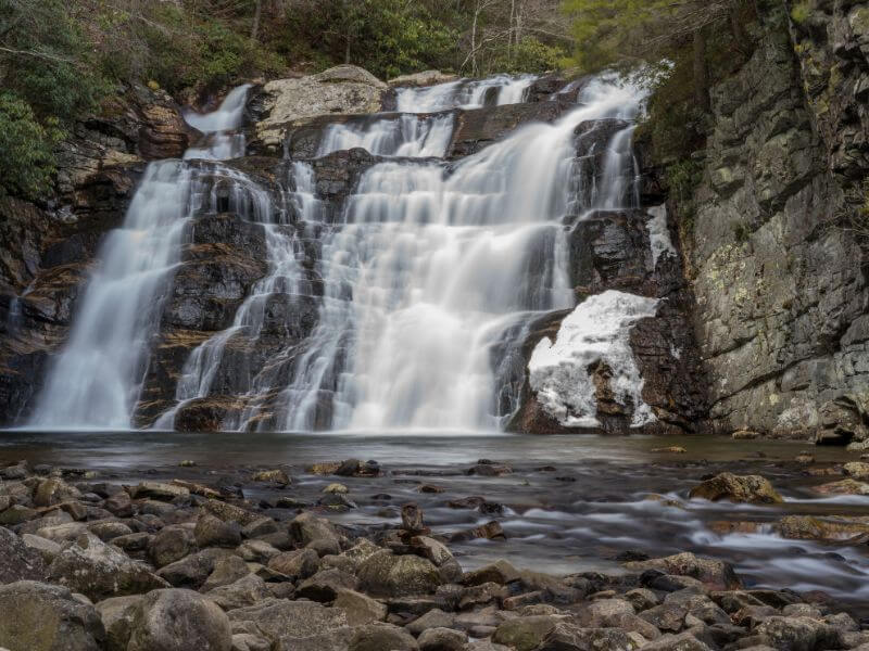
If you ask anyone who lives in the area what the best hikes near Johnson City are, I can almost guarantee that Laurel Falls would be on the list.
There are two different ways that you can reach the falls – one from the trailhead in Hampton and the other from the Dennis Cove Access on the Appalachian Trail.
The trailhead in Hampton is right off US-321 and you’ll see a sign for the Laurel Fork Trailhead Parking. Coming from this direction, the hike is about 4.6-miles and rated moderate.
From the Dennis Cove Trailhead, the hike is 2.6-miles but it is a bit steeper. If you’re short on time, this one may be your best option though.
There is a small rock scramble before you get to the falls so you’ll want to be aware of that if you have small kids or dogs.
This is one of the most popular waterfalls in Northeast Tennessee so the trail does get very crowded on weekends and the parking lot fills up quickly.
9. Coon Den Falls
- Distance: 3.6 miles
- Type: Loop
- Rating: Moderate
- Dog friendly? Yes
- AllTrails: Coon Den Falls (link is for loop hike, follow directions below for shorter out & back)
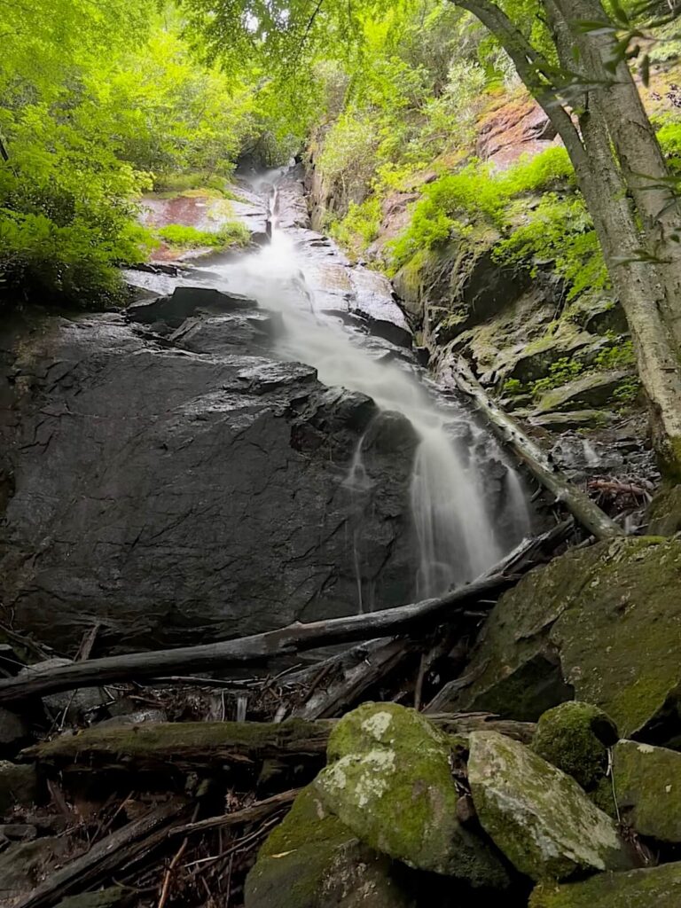
Coon Den Falls is an absolute hidden gem hike near Johnson City! You can do this one a variety of different ways but the easiest is from the new gravel lot directly across the trailhead from the Coon Den Falls Trail.
Here is the pin of the approximate location of that trailhead on Google Maps. You can also make a loop via the Appalachian Trail but you’ll have to walk along Dennis Cove Road for a portion of the hike if you do it that way.
It’s not a very busy road but there just isn’t much scenery to admire along that stretch.
The hike up Coon Den Falls Trail is a decent little hike in itself and relatively steep so trekking poles are helpful. You’ll also want to wear pants as the trail was a bit overgrown when I hiked it.
The falls are an impressive 50 feet tall and at the top, you can tell where the water is cutting through the rock as it wears it down. Really is cool to see.
There is a bench where you can rest near the base of the falls and it’s a great place for a snack.
Following AllTrails is helpful so you avoid getting lost when hiking since there are a few turns along this trail.
10. Margarette Falls
- Distance: 2.4 miles
- Type: Out & Back
- Rating: Moderate
- Dog friendly? Yes
- AllTrails: Margarette Falls
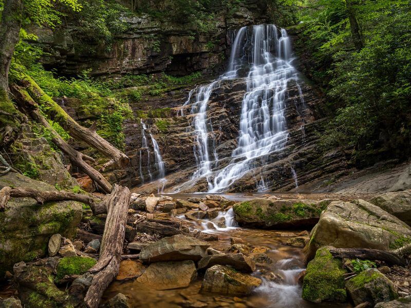
Another gorgeous waterfall near Johnson City, Margarette Falls is located in Cherokee National Forest near Greeneville.
For the first 0.5-mile, you’ll be on a gravel forest service road but then you’ll head into the woods.
This part of the trail follows the creek for most of the way and there is one creek crossing without a bridge.
The hike is about 2.4-miles out & back and rated as moderate. Once you make it onto the wooded trail, it’s pretty rocky and has lots of tree roots on the trail so good hiking shoes are ideal.
While Margarette Falls is the jewel of this hike, there are lots of other water features that make it interesting along the way!
Parks in Johnson City, TN
Myabe you’re just looking for a green space to hang out and have a picnic, take a short walk, or hang out with friends. These parks in Johnson City are the perfect place for that!
Founders Park
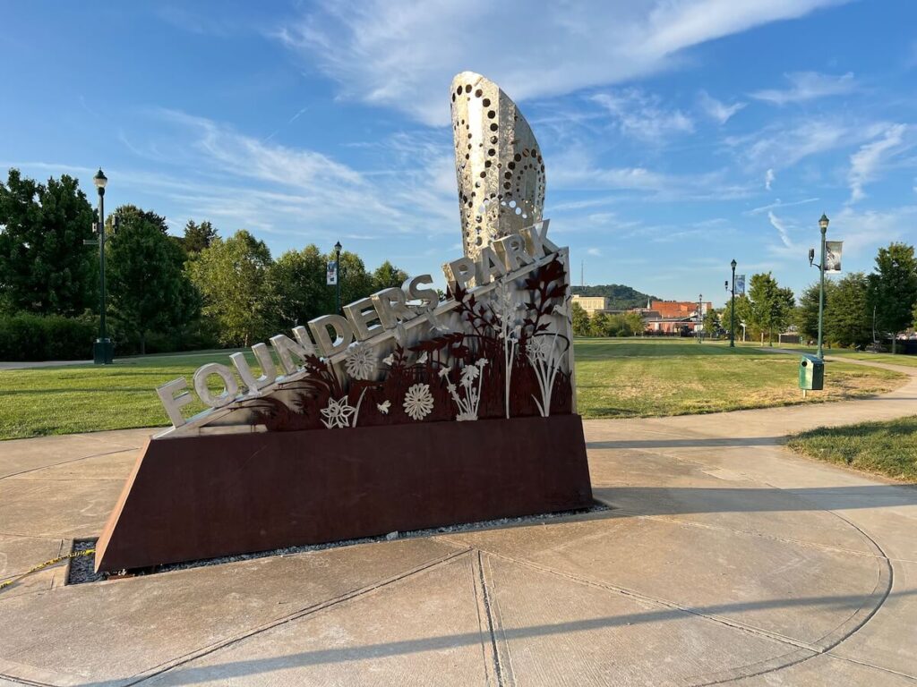
Located downtown, Founders Park has so many beautiful features. There are sidewalks that snake through the park that take you by beautiful outdoor art installations.
Large green spaces welcome people to bring frisbees or a blanket to lay out in the sun. There’s also a small creek that rushes through the middle of the park with a few small waterfalls along the way.
This is a great option located right next to Yeehaw Brewing and White Duck Taco and it makes for a great walking spot before or after dinner downtown.
Winged Deer Park
This 200-acre park has a little bit of everything from various athletic fields to mountain biking trails to a disc golf course and even lake access.
It sits right along Boone Lake with a picnic pavilion overlooking the lake and large green spaces to lounge or play.
There’s even a historical area to this park that contains the Robert Young Cabin, Massengil Monument, and the James H. Quillen Historical Tree Arboretum.
Of course, they also have a walking track and paved fitness trails so if you’re looking for an easy spot for a stroll that’s still beautiful, head here.
Jacob’s Nature Park at Sinking Creek
If you’re looking for wildlife, then Jacob’s Nature Park may be the place for you. It became a certified wildlife habitat in 2018 when it was recognized by the National Wildlife Federation.
Here you can find all kinds of fish, frogs, salamanders, birds, and butterflies if you visit during the right time. There are two different walking paths that lead you through forested areas and by Sinking Creek.
It’s just outside of town and perfect if you want to get in a quick walk outside.

FAQs on Hiking Near Johnson City, TN
What is the closest mountain to Johnson City, Tennessee?
Buffalo Mountain is the closest mountain to Johnson City which you can reach with a quick 10-minute drive from downtown to Buffalo Mountain Park.
What mountains can you see from Johnson City, TN?
From Johnson City, you can see the Blue Ridge Mountains surrounding town. The Blue Ridge Mountains are a subset of the Appalachian Mountain range.
Does the Appalachian Trail go through Johnson City?
The Appalachian Trail does not go through Johnson City, but you can reach an AT trailhead in 20 – 25 minutes from downtown. The closest ones are Laurel Fork Trailhead in Hampton and the trailhead at Chestoa in Erwin.
Wrap Up: Hiking Near Johnson City, TN
There you have it, ten of the best hikes near Johnson City! Many of these hikes are moderate to strenuous because of the elevation gain but you can find some easy trails like the Tweetsie Trail.
Remember to practice Leave No Trace and leave the trails better than you found them!
I had a great time hiking near Johnson City and I hope this guide helps you find the perfect trail for your own trip.

